Bélier, Ivory Coast
Côte d'Ivoire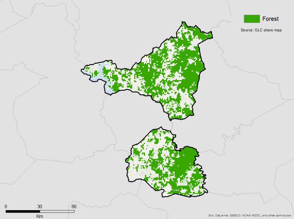
Description
Once the Region of Belier was exhausted of its land resources for the production of the main cash crops including coffee and cocoa, there was a large emigration of its people to other Ivorian agricultural frontiers. Straddling the forest and the savannah, the Belier Region has the advantage of green pastures. It offers the possibility of developing all forms of agricultural production, especially food crops, and animal and aquaculture resources. Its soil is also rich in minerals. As a hub region in central Ivory Coast, Belier has a large number of immigrants from ECOWAS countries and other African countries.
In both the forest and savannah areas, the ecosystems are severely degraded. The dominant economic activities of the Region are agriculture and livestock farming. Rural activities, the exploitation of the forest, coal mining, and bushfires are the greatest sources of pressure on the forest. The forest heritage is seriously degraded: the area occupied by the forest is 825.5 km² compared to 1850 km², 20 years ago.
To reverse the trend of regional forest degradation, the Regional Council has already recognized 4 communal forests of 5 hectares each and has planned the creation of 4 protected departmental forests of 10 hectares each.
Summary
Demographics
Economy
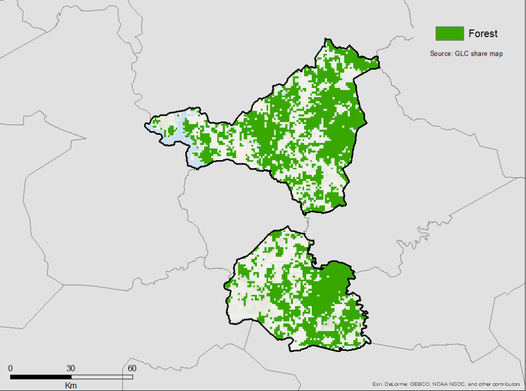
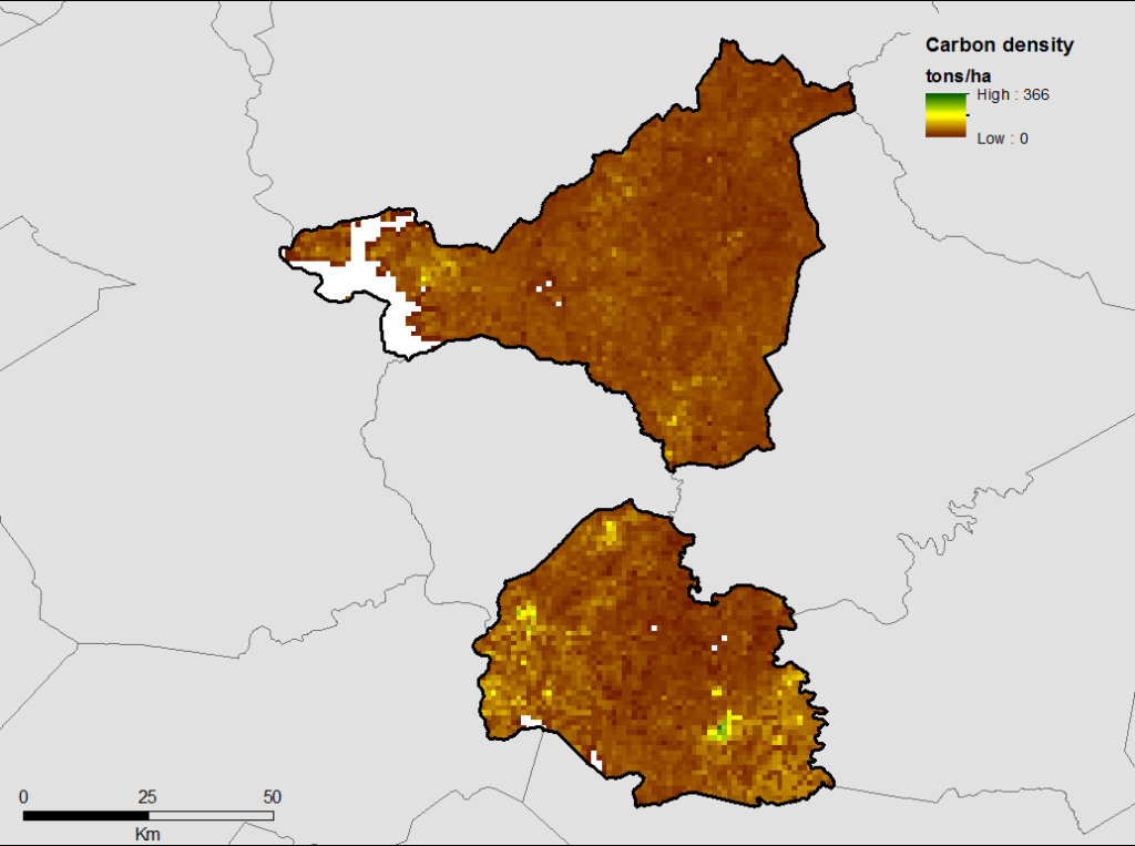
Forest Status
Forest Management
| Category | km² | |
|---|---|---|
| Classified Forests | 198 |
Drivers of Deforestation
The forest area of the Belier Region has decreased by 5.58% annually for the period from 1986 to 2000 and 2.97% for the period from 2000 to 2015. This trend has reversed as the area has been nearly completely deforested (825.5 km2, less than 2% of the total area)
According to the analysis of drivers of deforestation carried out at the national level (FAO and SEP-REDD +, 2016), the main driver of deforestation in Belier is agricultural expansion (68%), for cocoa farming, rice cultivation and rubber cultivation. The next driver is logging at 26%. The shares of mining and infrastructure expansion are minimal because they do not exceed 3% for each.
In addition, logging, firewood and bush fires are very important drivers of forest degradation. Bush fires result in the development of poor soils thus reducing the arable surfaces.
Under the effect of these drivers, the regional forest area has seriously deteriorated: the area occupied by the forest is 825.5 km² compared to 1850 km², 20 years ago.
These drivers are exacerbated by certain political and institutional factors, including political crises and the Government’s former political will to develop agriculture at all costs, by demographic factors (migration and population growth), and by economic factors, including the economic attractiveness of the region in relation to its level of development.
The region bases its hopes on the development of more efficient and diversified agriculture which must conform to the country’s commitments to sustainable practices regarding abandonment, deforestation, and the regeneration of the forests. REDD+, Zero Deforestation Agriculture, and Climate Smart Agriculture are the flagship initiatives that will need to be well coordinated with private sector initiatives and international donors to make economic and human development, and the conservation and regeneration of ecosystems compatible.
Deforestation Rates
Notes
| a. | Due to different methodological approaches and base years, Forest Status data fields may differ slightly. Data sources for each field are listed below. |
Overview of Forest Monitoring and Measurement Systems
The support of the UN-REDD Program has strengthened the capacities of the S&MNV unit in terms of personnel, equipment, and training, and for the development of pillars for the construction of the national forest monitoring system:
- For the forest inventory pillar, an inventory of forest biomass has been made and the country-specific emission factors for deforestation has been determined. The methodology of this first pilot inventory should be used for the planned National Forest Inventory in the course of 2018.
- For the spatial monitoring system of land, forest dynamics mapping (1986-2000-2015) was carried out thanks to the support of the UN-REDD Program10. SEP-REDD +’s S&MNV cell continues to work on the maps in order to refine them and finalize them in 2018.
- For the IGES, the reference level has been developed and the country is organizing to make the IGES produced at the national level coherent for the different official reports to be produced for the country.
Reference Levels and Targets
Deforestation Rates
Laws, Policies & Strategies
Strategies and Policies
Strategic Plan of Development of the Region of Belier (2014-2018) – This plan is a planning tool that identifies all of the economic and social sectors of the Region, identifies the major issues, establishes the priority needs, and defines the strategic orientations of the axes of development of the Region for the current period of 2014 to 2018.
Triennial Program 2018-2020 – For the next three years, this tool plans the priority development actions of the Region according to budget availability. The creation of protected forests is thus planned.
Partnership Agreement between BICICI and the Belier Region Council – An agreement between the Region and a private banking structure has been signed for the creation of an arboretum of 4 hectares that serves as a biological reserve of “reference” for the discovery, the ecological tourism, and the promotion of the environmental education and sustainable development.
These strategies and policies, listed above, do not concern REDD + and do not meet the needs of the region, for lack of significant funding. The Regional Council of Belier must update its Regional Development Plan (2014-2018) and this project will be an opportunity to introduce the elements of the field of REDD + and climate change into its design.
National Development Plan (PND 2016-2020)
National Agricultural Investment Program Phase 2 (PNIA 2018-2025)
National Action Program for the Environment (PNAE)
National Strategy for Fighting against Climate Change 2012
Declaration of Land Policy
Nationally Determined Contributions (CDN) of Ivory Coast
The Decentralization Policy of Ivory Coast organizes the national territory in 2 Autonomous Districts, 31 Regions, 108 Departments, 510 Sub-prefectures,
The National REDD + Strategy is to be implemented in all regions of the country, taking into account the elements considered in the REDD + tools put in place at national level including reference level of emissions for forests, system of information on safeguards, and national forest monitoring system.
Laws
Law no. 96-766 10/3/1996 – Environmental Code
Law no. 98-750 12/23/1998 modified by Law no. 2004-412 8/14/2014 – Relative to the Rural Land Domain
Law no. 2014-427 7/14/2014 – Forest Code
Law no. 2015-537 7/20/2015 – Agriculture Orientation in Ivory Coast
Institutional Framework
All Ministries and structures, below, have local directorates or representations.
The Ministry of Water and Forests is responsible for the management of water and forests at the national level. This Ministry manages the state’s rural forest estate.
The Ministry of Agriculture and Rural Development is in charge of the state’s agriculture and rural development policy. He manages the rural land.
The Ministry of Health, Environment and Sustainable Development is in charge, at the national level, of the policy of the environment and sustainable development. SEP-REDD + is under the supervision of this Ministry.
The Ministry of Animal and Fisheries Resources is in charge of the national policy of animal and fish resources.
The Ministry of the Interior and Security is in charge of the administrative and security management policy of the country.
The Ivorian Office of Parks and Reserves (OIPR) manages the parks and reserves of the Ivorian State.
The Forest Development Corporation (SODEFOR) manages the permanent forest estate of the State.
Zoning & Spatial Planning
The Region of Belier is comprised of two economic and ecological zones:
- The southern zone is composed of two departments (i) Toumodi and (ii) Jekanou. In this zone, coffee, cocoa, rubber and palm oil are cultivated. Rainfall in this area is higher than in the north.
- The northern zone is composed of two departments (i) Tiébissou and (ii) Didiévi, and is less watered. The vegetation of this zone is the savannah. The main activity is the cashew nut.
Partnerships and Ongoing Initiatives
Agribusiness Development in the Region of Belier
- Description
-
This BAD-funded project is under preparation and is targeting the central region. It aims to promote a sustainable increase in productivity for cash crops with high economic potential, with particular emphasis on young people, women, and PMEs. This project will be implemented through 3 components:
- Community infrastructure development;
- Development of high potential value chains;
- Support for adaptation to climate change.
4,400 producers (farmers, traders, etc.) will benefit from the project, including about 2,200 women. The increase in production should generate an additional income of about 2.2 million FCFA per year and per farm for rice producers, and 3 million FCFA for large producers.
- Partners
- BAD / Belier Regional Council
- Funding Source
- BAD
- Funding Amount
- $135 Million
- Initiative Type
- Regional Project
- Initiative Status
- In Preparation
Agricultural Sector Support Project (PSAC)
- Description
-
This project, financed by the World Bank to the tune of 25 billion FCFA, aims to strengthen the added value of export products, in close collaboration with the interprofessionals of Natural Rubber (APROMAC) and Palm Oil (AIPH), as well as with the Coffee Cocoa Council (CCC). Increasing the value added of export products is likely to result in greater stability of cocoa production, particularly in Classified Forests, and thereby contribute to creating a favorable environment for agroforestry contracting to enhance the effectiveness of the interventions of the projects of the PIF.
- Partners
- MINADER, WB, AFD, APROMAC, AIPH, CCC
- Funding Source
- World Bank
- Funding Amount
- $50 Million
- Initiative Type
- National Project of Application to Belier
- Initiative Status
- In Progress
Cocoa and Forest Initiative
- Partners
- MINEF / World Cocoa Foundation (WCF) / The Sustainable Trade Initiative (IDH)
- Initiative Type
- National Project of Application to Belier
- Initiative Status
- In Preparation
Creation of Communal Forests in the Four Departmental Capitals (Toumodi, Djékanou, Tiébissou and Didiévi)
- Description
-
This initiative is aimed at the construction of four forests of 5 hectares each near the towns of Toumodi, Djékanou, Tiébissou and Didiévi.
As a result of the initiative, the Region of Belier wants to regenerate the degraded vegetation cover and eventually reverse the negative effects of climate change. The Region of Belier wants to give these actions capital importance, as the protection and the respect of our environment daily deteriorates.
- Funding Source
- CR Belier
- Funding Amount
- $18,750 USD
- Initiative Type
- Financial Initiative
- Initiative Status
- Achieved in 2015 and 2016
Creation of Four Protected Forests in the Four Departments of the Belier Region
- Description
-
This initiative aims to create new forest cover (reforestation).
As a result of the initiative, this project will allow the restoration of vegetation cover with a goal of (i) improving climatic conditions, (ii) reducing the emission of greenhouse gases including CO2, and (iii) improving the living conditions of producers of food and cash crops.
The Region of Belier, through this project, would like to take an active part in the global environmental protection initiative.
- Funding Source
- CR Belier
- Funding Amount
- $149,837 USD
- Initiative Type
- Financial Initiative
- Initiative Status
- 2018-2019-2020
RSPO National Interpretation Project
- Description
-
The objective of this initiative, funded by the Ivorian Government, is to achieve a national interpretation of the RSPO (Round Table for Sustainable Palm Oil) standard to facilitate the obtaining of RSPO certification by Ivorian palm oil producers. The first beneficiary of the project is the Interprofessional Association of the Palm Oil Industry (AIPH). The results of the project will provide lessons on the potential benefits of certification in other sectors where the FIP will operate, including the teak-related economic value chain or cocoa farms implementing agroforestry practices.
- Partners
- Ministry of Agriculture and Rural Development (MINADER)
- Funding Source
- Ivorian Government
- Initiative Type
- National Project of Application to Belier
- Initiative Status
- In Progress
Support for initiatives focusing mainly on the creation of teak forests on relatively small areas
- Partners
- CARE International
- Initiative Type
- Regional Project
- Initiative Status
- In Progress
Support for the development of rubber, teak, and cashew in the regions of Aries, Iffou and N'Zi
- Partners
- Regional Council of Belier (CRB)
- Initiative Type
- Regional Project
- Initiative Status
- In Progress