Chiapas, Mexico
Mexico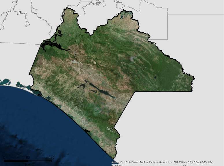
Description
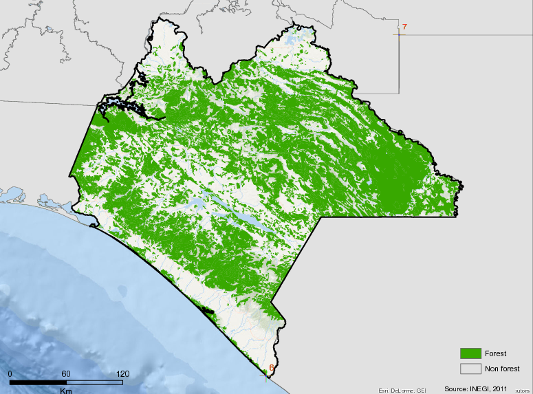
Chiapas is the eighth largest state in Mexico, with an area of 73,282 km², which represents 3.8% of the total area of Mexico. It has a rich biodiversity with cloud forests, temperate, natural and induced grasslands, humid, tropical, and sub-humid areas and tropical rainforest (INEGI, 2010). These different types of forests cover 42% of the total area of the state (PACCCH, 2011). As a result, 30% of Mexico’s surface waters are located in Chiapas. It also has 47 Natural Protected Areas covering 19.8% of the total surface area of the state (SEMAHN, 2010).
In 2009, the state government launched the Climate Change Action Program for the State of Chiapas (PACCCH), with the participation of many local and national actors. PACCCH generated an analysis of deforestation and forest degradation in the state and created projections for the future, as well as a state inventory of greenhouse gases. The institutional and legal framework for mitigation and adaptation to climate change was created through the publication of the Adaptation and Mitigation to Climate Change that established the Inter-institutional Climate Change Coordination Commission of the State of Chiapas, a group of 15 state government agencies with responsibility for implementation. In a certain sense, the development and implementation of adaptation and mitigation policies is a result of the participation of many actors of organized civil society.
The Technical Advisory Board of REDD + (CTC REDD + CH), officially established in 2011, is currently working with the Ministry of Environment and Natural History on the regulations for climate change and the development of the State REDD+ strategy, with input from civil society organizations, dederal agencies, and academic institutions in Chiapas. The objective is to issue a state REDD+ strategy in 2013, and a REDD+ regional strategy for 2015. The state is working to align its efforts with the National Vision for REDD+ and the National REDD+ Strategy, in this sense, attending meetings with the Technical Council REDD+ National Consultative and aligning efforts on issues of: safeguards, goals and processes, Monitoring, Reporting and Verification, and institutional and legal frameworks.
Additional information can be found on the GCF Impact Platform.
Summary
Demographics
Urban vs. Rural Population
| Category | % | |
|---|---|---|
| Rural | 52.00 | |
| Urban | 48.00 |
Ethnic Groups
| Group | % | |
|---|---|---|
| Mestizo | 77.42 | |
| Tzeltal | 9.00 | |
| Tzotzil | 8.20 | |
| Chol | 3.80 | |
| Zoques | 1.10 | |
| Tojolabales | 1.06 | |
| Other | 0.50 |
Economy
GDP Breakdown
| Category | % | |
|---|---|---|
| Services | 78.00 | |
| Industry, Mining | 13.00 | |
| Agriculture, Forestry | 9.00 |
Forest Status
Major Vegetation Types
| Category | km² | |
|---|---|---|
| Primary Perrenial | 12,303 | |
| Conifer Forest Primary | 4,379 | |
| Primary Mesophytic Forest | 4,309 | |
| Secondary Perennial Forest | 3,409 | |
| Secondary Deciduous | 2,238 | |
| Secondary Mesophytic Foresty | 1,823 | |
| Primary Encino Forest | 1,328 | |
| Secondary Encino Forest | 999 | |
| Primary Deciduous | 869 | |
| Secondary Coniferous | 355 | |
| Secondary Sub-deciduous Forest | 160 |
Forest Management
| Category | km² | |
|---|---|---|
| Ejido | 27,677 | |
| Protected Area | 10,521 |
Drivers of Deforestation
Changes in land use are caused by conversion to grazing pastures and agriculture. Other factors that contribute to deforestation (from the regression analysis in PACCCH, 2011) include: population density, distance to roads, distance to cities / towns, distances from agricultural or livestock areas, and slopes.
Deforestation Rates
Notes
| a. | Due to different methodological approaches and base years, Forest Status data fields may differ slightly. Data sources for each field are listed below. |
Sources
| 1. | Mexico FREL link |
| 2. | INEGI, 2013. Volumen y crecimiento. Población total por entidad federativa, 1895 a 2010 link |
| 3. | INEGI, 2011. Pespectiva estadistica Chiapas link |
| 4. | INEGI, 2011, Perspectiva estadistica Chiapas link |
| 5. | |
| 6. | |
| 7. | Anuario estadístico. Chiapas, Edición: 2012, Cobertura temporal: 2011, Desglose geográfico: Municipal, ISSN: 0188-8587 |
| 8. | Programa de las Naciones Unidas para el Desarrollo (PNUD, 2010): El Indice de Desarrollo Humano en México: cambios metodológicos e información para las entidades federativas link |
| 9. | CONAFOR 2014 |
| 10. | INEGI/FCPF FREL |
| 11. |
Overview of Forest Monitoring and Measurement Systems
Since the Cancun agreements in 2010 (1 / CP 16), countries that wish to participate in mechanisms to reduce emissions from deforestation and forest degradation know that they must have a national forest monitoring system and a baseline of emissions forestry (NREF) or a forest reference level (NRF). Although the UNFCCC has not established the difference between the two, it is generally understood that the NREF only includes activities that reduce emissions from deforestation and forest degradation, and the NRFs include both activities that reduce emissions and activities that capture carbon.
Mexico, as a country interested in implementing a REDD + mechanism at the national level has prepared its Strategy, which includes the components of Reference Level and Monitoring, Reporting, and Verification, which have experienced a great advance thanks to the funding received from the Government of Norway through the project “Strengthening REDD + and South-South Cooperation”.
Chiapas is one of the participating states in the Emissions Reduction Initiative (IRE), for which the State Government signed with CONAFOR the Coordination Agreement for the IRE, according to which CONAFOR commits itself, in relation to the monitoring of emissions and reference level, to deliver to the state the state inputs, databases, and cartography generated for the reference level. The INFyS, the IEFyS and the information may be useful for decision-making in the state, although it does not establish dates or deadlines to make such deliveries. In addition, CONAFOR will generate information that allows the evaluation of the results of the actions undertaken within the framework of the IRE through the SNMF and will support, to the extent of its possibilities, the development of capacities in the state regarding MRV. The state, for its part, undertakes to report the reduced emissions in its jurisdiction within the framework of the IRE.
It should also be noted that the ENAREDD + talks about the implementation of an MRV system nested between the national, state, and local scales, which promotes local and community participation, contemplating lines of action for capacity building, and the development of institutional arrangements for its implementation at multiple scales in a consistent and integrated manner. So far, Mexico’s main effort in relation to MRV for REDD + has focused on the development of capacities and products on a national scale, although some experiences have also been developed at the state and local levels.
At the state level, Chiapas has a GT-MRV created in 2014 as a space for social participation, where state and federal government agencies meet with academics and civil society organizations, under the coordination of the Ministry of Environment and Natural History (SEMAHN; Line and Fong, 2016a). This group was formally constituted through a memorandum of understanding in March 2016. Of the19 technical signatories, 9 are women and 10 men, which is indicative of the high level of involvement of women in the subject of the MRV at the state level.
The GT-MRV has been established as a key element for MRV at the state level, highlighting the importance and potential of considering local information in a national monitoring system nested to the national system. It has generated important information to improve the estimates of the factors of emission and activity data related to deforestation and forest degradation at the sub-national level and has created a space for dialogue between the states and the SNMF. This is making it possible to advance the definition of the roles of the different instances and scales of action. As part of the implementation of this Strategy, it is proposed to change the name of the GT-MRV to the State MRV Group (GE-MRV), to avoid confusion with the Working Groups (GT) of the CCICCCH and the CCCCCH.
The activities with potential to reduce emissions from the AFOLU sector in the state of Chiapas have been organized into sectors (forestry, agriculture, and livestock) and, within the forestry sector, three blocks have been differentiated which establish their priority for monitoring in the state:
- Block I: Deforestation, forest degradation and fire degradation;
- Block II: Reforestation and restoration; and
- Block III: Forest management, increase of forest carbon reserves.
The priority activities for monitoring are those of Block I of the forestry sector, which are those considered by the SNMF and have the most associated information.The monitoring of these activities implies, therefore, the alignment with the methodologies and inputs used by the SNMF. Although, on the other hand, the opinions of external experts on these issues will be taken into account.
The state vision for REDD + attaches great importance to the role of biodiversity and ecosystem services, so the state system will include parameters and related variables, as well as others associated with productive activities, trying to disaggregate information by gender, ethnicity, and age when possible.
The information necessary to build the state monitoring system will therefore come from different institutions, agencies and systems, which implies the need to formalize an institutional structure that includes all the key actors for this issue and allows the adequate flow of information. The IRE Convention between CONAFOR and the state government is an example of the kind of instruments that can be used to advance this issue. The system will also consider a phased approach to include data at the selected scales, as they become available.
Another important challenge for the state is having the necessary capabilities and infrastructure for the design and operation of the system. The members of the state WG-MRV have received training on the methodologies used by the SNMF, although the capacities created have focused on the monitoring of deforestation and forest degradation, and training processes must be designed that incorporate all the mitigation activities of the AFOLU sector of interest for the EEREDD +. Likewise, it is important to promote a basic understanding of this component among decision makers and key state actors.
In relation to the local scale, it is also considered necessary to strengthen the capacities of municipal technicians and community brigades, in order to encourage their active participation in the state and national monitoring system and to promote a “bottom-up” construction in monitoring of the forests. In the state there are already experiences of training of community brigades and monitoring of carbon stores in forest systems (Line et al., 2016) and land uses. The information generated by the trained brigades can be very useful to fill gaps in information, generate knowledge about sustainable productive activities and improve the identification of local species, among others (Line et al., 2016), as well as generate carbon inventories from all land uses at the local level (Rojas et al., 2014).
The participation of women in these exercises of training and data collection in the community level has been favored, however, on occasions, traditional gender roles have prevented a greater involvement of women in these activities.
The institutional structure and capacity building will allow the adequate operation of the state monitoring system, which will be aligned with the national system and will have the capacity to incorporate information on other mitigation activities in the AFOLU sector. The GE-MRV, as part of the system, will identify the information generation needs and define the necessary data collection and processing protocols. The system will operate through a virtual platform which will be compatible with other platforms and systems, will incorporate multilevel information and will be freely accessible, giving transparency to the mechanism, generating trust to the financiers and facilitating the verification processes.
Reference Levels and Targets
Deforestation Rates
Sources
| 1. | Rio Branco Declaration based on National FREL |
| 2. | INEGI/FCPF FREL |
Laws, Policies & Strategies
Strategies and Policies
Climate Change Action Program (PACCCH) – Chiapas completed the first phase and entered the second phase of its PACCCH, which began in 2009. The Program includes objectives to involve researchers to increase scientific knowledge about climate change, complete state inventories of greenhouse gases, analyze the deforestation and forest degradation in the state, and analyze future climate scenarios. The program is supported by the Climate Change Adaptation and Mitigation Law of Chiapas (Decree 190/2013).
State REDD+ strategy (EEREDD+) – Chiapas has developed a draft EEREDD+ that will be used as a basis for consultation in priority regions (Selva Lacandona, Frailescana, Costa-Istmo and Mezcalapa). In addition, Chiapas considers timely action of REDD + (ATREDD+) and is part of the Emission Reduction Initiative (IRE) of the federal government with the FCPF.
Carbon Fund Investment Program of the FCPF – Chiapas has developed an investment program to reduce deforestation through Mexico’s Emissions Reduction Initiative of Mexico implemented within the framework of the Forest Carbon Partnership. The Emissions Reduction Initiative is based on four pillars: improving intersectoral coordination, actions to address the specific deforestation drivers of the site, and the development of policies and programs.
The State Development Plan (Plan Estatal de Desarrollo – PED) – proposes a basic vision for the development of the Strategy in three axes and seven public policies.
Laws and Regulations
Decree no. 190 5/24/2013 – Law for Adaptation and Mitigation of Climate Change for the State of Chiapas – Originally published in 2010, but was replaced by Decree 190/2013. It provides a basis for actions to reduce deforestation in the state and promotes the Climate Change Action Program, which establishes the steps that the state government should take to build a REDD+ mechanism in more detail, and establishes the Inter-secretarial Exchange Commission.
Decree no. 189 4/18/2009 – Environmental Law of the State of Chiapas – Establishes the regulatory framework for environmental issues for the State of Chiapas. Its objective is the conservation of biodiversity, the restoration of ecological balance, environmental protection, and the rational use of natural resources to promote sustainable development of the state, establishing the basis for issues such as indigenous rights and environmental protection.
Decree no. 145 10/20/2008 – Sustainable Silviculture in the State of Chiapas – Promotes the payment of ecosystem services (PES), including carbon sequestration, and declares, under Chapter 7, that all federal, state, and municipal funds for PES should be directed through the Forest Trust (Fideicomiso Forestal).
Decree no. 207 7/29/1999 – Law of Indigenous Rights and Culture of the State of Chiapas – Regulated by Article 7 of the Political Constitution of the State and its observance is of public order and social interest where the following protected indigenous peoples of the Chiapas State are recognized: Tzeltal, Tzotzil, Chol, Zoque, Tojolabal, Mame, Cakchiquel, Lacandón, Mocho, Jacalteco, Chuj, and Kanjobal.
Institutional Framework
Inter-Institutional Coordination Commission on Climate Change of the State of Chiapas (CCICCCH) – Presided over by the Governor and, in his absence, by the minister of the SEMAHN. The CCICCCH is composed of the ministers of the organs of the state public administration as presented in chapter IV of the LAMCCCH. The CCICCCH is responsible for government coordination in the area of Climate Change in the State of Chiapas and its resolutions and opinions are binding on the bodies that make up the state public administration (Article 15). The CCICCCH has several Working Groups (WG), two of which are related to the REDD+.
Climate Change Advisory Council of the State of Chiapas (CCCCCH) – Has the function of advising the CCICCCH and among its faculties is to follow up on the policies, actions ,and goals foreseen in the REDD+ Strategy.
The CCCCCH was created on February 25, 2014 and is integrated by the government sector through the Secretary of the SEMAHN (President) and the Under Secretary of Climate Change of the SEMAHN (Technical Secretary). It is composed of 13 ministries of the state public administration, responsible for designing and implementing climate change policy in the state in accordance with the Law of Adaptation to Climate Change and Mitigation.
Ministry of the Interior of the State (SECAM) – Directs, coordinates, and promotes compliance with the national and state plans, agricultural development programs, livestock and forestry, as well as development actions and policies of the state. SECAM also applies strategies and technological innovations to increase the efficiency of the agriculture and livestock sectors in Chiapas.
Ministry of Civil Protection (MPC) – Directs the actions implemented for the agencies of the Ministry oriented to integrated disaster risk management.
State Ministry for Indigenous Peoples and Cultures (SEPCI) – Promotes the recognition, respect, and full exercise of the collective rights of the 12 indigenous groups in Chiapas, people who represent the cultural wealth of our state and are recognized by the local constitution.
Attorney General of the State (PRO) – Represents society in the investigation and prosecution of environmental crimes, with the principles of legality, honor, efficiency, security, and legal certainty, which allows a functional structure of the Attorney General’s office, guaranteeing the integral development of the rule of law.
REDD+ Technical Advisory Committee – Comprised of local NGOs, academics, and federal government agents in social, technical, political, cultural, and environmental aspects of REDD+, including Pronatura Sur, the AMBIO Cooperative, the National Forestry Commission, the National Commission for Natural Protected Areas, ECOSUR, COLPOS, Na Bolom Cultural Association, The Nature Conservancy, Mesoamerican Biological Corridor, Conservation International, and the Environmental Defense Fund.
Working Group on Monitoring and Monitoring Information (GT MRV) – A technical GT MRV consisting of a variety of government, university, and civil society stakeholders, which promotes the monitoring and measurement of emissions from deforestation in the state.
Zoning & Spatial Planning
Territorial and Ecological Zoning Programs
The Ministry of the Environment and Natural History has developed Territorial and Ecological Zoning Programs in several regions of the state. The basis for zoning is described in Publication 1574/2010 and you can find a general desctiption of the progress here.
The Territorial and Ecological Zoning Programs are in various stages of development, as detailed below:
The Ministry of the Environment and Natural History has planned, published, implemented, or modified the Territorial and Ecological Zoning Programs in the following places at various stages of development:
- Currently in planning stage:
- Oil Zone North Region V (Sub 2: Amato, Ixtacomitan, Ixtapangajoya and Solosuchiapa)
- Areas affected by Hurricane Stan in the Isthmus Coast
- Sierra and Soconusco Regions (for Ecological Research)
- Tapachula
- Chiapas Coast (and Cintalapa Badoancho Basins)
- Metropolitan Area of Tuxtla Gutiérrez
- Zoning Program l for the Rio Grande Basin
- Lagunas de Montebello National Park (Comitán, La Trinidad, La Independencia and Las Margaritas)
- Published:
- State of Chiapas (POETCH) at a larger scale – 2012
- Oil Zone North Region V (Subregion 1: Reform, Juarez, Sunuapa, Ostuacan and Pichucalco)
- In the Execution Phase:
- Sub-basin of the Sabinal River (POETSAB) – 2010
- Subbasin of the Lagartero River( POETLAG) – 2010
- Sub-basin of the Coapa River Pijijiapa – 2012
- Under Evaluation:
- Beaches of Catazaja
- Under Modification:
- Sub-basin of the Zanatenco River, Tonala – 2004
Engagement & Participation with Indigenous Peoples and Local Communities
The REDD + Safeguards of the UNFCCC reflect human rights, environmental and governance obligations, as well as commitments previously agreed upon in various international instruments to which REDD + countries are a part. Even before the Cancun Agreements, in the framework of the UNFCCC, as a result of discussions arising from the Bali Action Plan, countries recognized that activities to reduce emissions from deforestation and forest degradation in countries in development pathways “can generate related benefits and complement the aims and objectives of other relevant international conventions and agreements.”
Safeguard: International Law
The wording of the REDD + Safeguard (a) of the UNFCCC is: “The complementarity or compatibility of the measures with the objectives of the national forestry programs and of the conventions and international agreements on the matter.”
In order to understand and interpret the REDD + Safeguard (a) of the UNFCCC, it is necessary to examine the two main concepts that comprise it, as well as its implications:
- REDD + activities should complement or be compatible with the objectives of national forest programs.
- REDD + activities must complement or be compatible with the objectives of conventions and international agreements.
Complementarity or Compatibility with the Objectives of Conventions or International Agreements
The REDD + Safeguard (a) of the UNFCCC reaffirms the relationship between REDD + objectives and those of international conventions and agreements. Decision 1 / CP.16 states that all actors should “promote and support” the UNFCCC REDD + Safeguards, including the Safeguard, which requires that REDD + activities complement or be compatible with international instruments on the subject. REDD + countries must also show that they are “addressing and respecting” all safeguards, through the SIS, which in this case, will be necessary for countries that demonstrate that REDD + measures have been implemented by fulfilling the commitments made under of the relevant international instruments.
The above means that the REDD + Safeguard (a) of the UNFCCC in addition to ensuring that the measures to implement REDD + are carried out in a manner compatible with international obligations, the REDD + Safeguard (a) of the UNFCCC represents an opportunity for REDD + countries to guarantee better compliance with their international obligations. This implies the need to recognize and take measures to adequately complement and be consistent with relevant and applicable international conventions and agreements. Therefore, the countries that carry out REDD + measures must clearly identify the applicable and pertinent international agreements, and analyze to what extent the proposed REDD + activities complement or are compatible with the international conventions and agreements identified.
It is important to note that ensuring the coherence of REDD + measures with the relevant international instruments should not be seen as an additional requirement that countries must comply with in order to implement REDD +. The consideration of these international instruments will help countries to align the REDD + Safeguards of the UNFCCC with their current commitments and aspirations regarding the governance reforms necessary for the sustainable management of their forests, as indicated when ratifying the international instruments on the subject. By ensuring such coherence, REDD + countries will be able to implement the UNFCCC REDD + Safeguards based on an existing national system developed to comply with the relevant international instruments.
Convention No. 169 of the International Labor Organization (ILO) on Indigenous and Tribal Peoples.
Since its creation in 1919, the International Labor Organization (ILO) has paid special attention to the situation of indigenous and tribal peoples. In 1957, the first binding international instrument was adopted, the Convention No. 169 of the International Labor Organization (ILO) on Indigenous and Tribal Peoples.
In this regard, the Convention constitutes a key element in the ILO’s action in favor of social justice, an objective reaffirmed in 2008 with the adoption of the Declaration on Social Justice for a Fair Globalization.
Convention No. 169 has two basic postulates: the right of indigenous peoples to maintain and strengthen their cultures, ways of life and their own institutions, and their right to participate effectively in the decisions that affect them. These premises constitute the basis on which the provisions of the Convention should be interpreted.
The Convention also guarantees the right of indigenous and tribal peoples to decide their own priorities regarding the development process, insofar as this affects their lives, beliefs, institutions and spiritual well-being and the lands they occupy or use in some way, and to control, to the extent possible, their own economic, social and cultural development.
When ratifying an ILO Convention, a member state undertakes to adapt the national legislation and develop the relevant actions according to the provisions contained in the Convention. It also undertakes to report periodically to the supervisory bodies of the ILO on the application in practice and legislation of the provisions of the Convention and to respond to questions, comments, or suggestions from those supervisory bodies.
As of November 2014, Convention No. 169 has been ratified by 22 countries, the majority of our region: Argentina, Bolivia, Brazil, Chile, Colombia, Costa Rica, Dominica, Ecuador, Guatemala, Honduras, Mexico, Nicaragua, Paraguay, Peru and the Bolivarian Republic of Venezuela, as well as Denmark, Spain, Fiji, Nepal, Norway, the Netherlands and the Central African Republic.
On September 13, 2007, Convention No. 169 was reinforced by the United Nations Declaration on the Rights of Indigenous Peoples, adopted with a very large majority by the General Assembly of the United Nations. With this adoption, a process of more than two decades led and promoted by representative organizations of indigenous peoples was completed.
The Declaration consists of 44 articles that establish the minimum standards of respect for the rights of indigenous peoples, including the right to ownership of their lands, the natural resources of their territories, the preservation of their traditional knowledge, self-determination, and prior consultation. This Declaration also recognizes individual and collective rights related to education, health and employment. The Declaration is a basic reference that can be invoked to protect indigenous peoples against discrimination and marginalization to which they are still exposed and mutually reinforcing with Convention No. 169 by sharing objectives and principles.
Convention No. 169 is today a point of reference at the international level not only for United Nations agencies and international financial institutions, but also for regional bodies on human rights and national courts of justice.
In order to guarantee the rights of indigenous peoples, the provisions of article 6 of Convention No. 169 of the International Labor Organization (ILO) on Indigenous and Tribal Peoples will be met, which states the following:
- Article 6
- In applying the provisions of this Convention, governments shall:
- (a) Consult the interested peoples, through appropriate procedures and in particular through their representative institutions, whenever there are legislative or administrative measures that may directly affect them;
- (b) Establish the means through which the interested peoples can participate freely, at least to the same extent as other sectors of the population, and at all levels in decision-making in elective institutions and administrative and other bodies responsible for policies and programs that concern them;
- (c) Establish the means for the full development of the institutions and initiatives of these peoples, and in appropriate cases provide the necessary resources for this purpose.
- The consultations carried out in application of this Agreement must be carried out in good faith and in a manner appropriate to the circumstances, in order to reach an agreement or obtain consent on the proposed measures.
- In applying the provisions of this Convention, governments shall:
The consultation has a procedural character through which the human and collective rights of the communities and indigenous peoples are guaranteed. The effect of a consultation carried out in accordance with ILO Convention 169 and the United Nations Declaration on the Rights of Indigenous Peoples, is to achieve consensus among the parties.
Therefore, this process is an intercultural dialogue that takes place between indigenous peoples and government agencies that intend to implement an administrative medium or a project that affects indigenous peoples. The proper application of these mechanisms helps to prevent and resolve conflicts of interest as well as build inclusive and respectful development projects.
To achieve these objectives there is no single formula that can be applied in all countries and in all circumstances in relation to the implementation of consultations. Therefore, the nature and scope of the measures adopted to observe and guarantee the exercise of the right to consultation must be determined with flexibility, taking into account the conditions of the state, region or locality, indigenous people who are consulted, social, economic, political, cultural conditions, etc., to ensure the conditions for the establishment of agreements, or, of free, prior and informed consent.
In accordance with the situation in question, three levels of participation of indigenous peoples can be recognized:
- When the measure that concerns them is applicable to the entire indigenous population of the country, where there would be the right to participation;
- When administrative or legislative measures are likely to affect them directly, where the State has the duty to carry out prior consultation to reach agreements; and
- When the affectation is of such a degree in which case the consultation is not enough but the free, prior and informed consent is necessary.
According to the 169 of the ILO, free, prior and informed consent is required for the following cases:
- When the project involves the transfer of indigenous peoples from their traditional lands (UN Declaration, Indigenous Peoples, Article 10).
- When the project involves the storage or disposal of hazardous materials in their territories (UN Declaration, Article 29.2).
- In the case of large-scale development or investment plans that could have a greater impact on indigenous territories (I / A Court HR, Saramaka vs. Suriname case, paragraph 133).
- When it comes to activities of extraction of natural resources in indigenous territories that have significant social, cultural and environmental impacts (Special Rapporteur of the United Nations on the Rights of Indigenous Peoples, 2010).
In order to carry out the definition of the arrangements for the distribution of benefits at the local level, a process of making agreements with the agrarian communities must be carried out, and in the case of indigenous peoples, consent will be sought, prior, free and informed, both processes through a participatory approach.
It will be guaranteed that the design and implementation of this methodology did not generate any type of exclusion. The process for making agreements or consent will be taken with the representatives of the intervention areas of the communities and indigenous peoples.
The Cancun Agreements, signed at COP-16 (Cancun, Mexico) of the UNFCCC, established the elements that must be developed by countries that want to participate in REDD + mechanisms, including the existence of a Safeguard Information System (SIS). In this meeting, in addition, guidelines for the design of REDD + mechanisms, known as “Safeguards of Cancun”, were formulated.
The state of Chiapas has very special social and environmental characteristics, which must be recognized and guaranteed, such as the rights of local communities, indigenous and non-indigenous. Traditional aspects, biodiversity, and culture linked to these communities need to be addressed respecting traditional governance, full and effective participation, inclusive participation, providing opportunities for young people and women from communities, and promoting processes for rural development of sustainable lower emissions.
Partnerships and Ongoing Initiatives
Bonn Challenge
- Description
-
The Ministry of Environment and Natural History (SEMAHN) of the Government of the State of Chiapas and the International Union for the Conservation of Nature (IUCN) are carrying out the design of a functional strategy of landscape restoration with an approach that encourages productivity and supports the objectives set out in the Chiapas State Development Plan 2013-2018. It also facilitates compliance with the commitments made in different international agreements at the national level (the 15 Aichi goals of the CBD, the UNFCCC REDD + goal, the zero net land degradation goal of Rio + 20) and at the state level (Rio Branco Declaration on low-emission rural within the framework of the GCF Technical Team). The design of the strategy is the first step for the State Government to join the global Bonn Challenge initiative (http://www.bonnchallenge.org/), whose objective is to restore 150 million hectares of deforested and degraded lands by 2020 and 350 million by 2030.
- Partners
- State of Chiapas, IUCN, NGOs
- Initiative Type
- Government Planning Initiative
- Initiative Status
- Development of the Action Plan 2017-2018
Chiapas Emission Reduction Initiative
- Description
-
On April 22, 2016, the Government of the State of Chiapas, through the Chief Executive, signed an agreement with the National Forestry Commission (CONAFOR) for a Coordination Agreement for the development and implementation of the Emissions Reduction Initiative through investment programs with scope in the territorial district of the state of Chiapas.
The specific activities that will be developed within the framework of the Initiative for the reduction of emissions have been defined according to local realities to ensure that the causes of deforestation and forest degradation in each region of the State are addressed. To implement the economic activities in a sustainable and long-term manner, it is necessary to have a state financing scheme that allows the capture of financial resources from different national and international, public and private sources, that can function as an investment that will impact the development of sustainable rural activities and the development of capacity in producers, associations of producers, and communities of the state.
- Partners
- Government of Chiapas, CONAFOR, World Bank, FCPF
- Funding Source
- National and International sources from public and private sectors
- Initiative Type
- Pay for performance, Private Investment
- Initiative Status
- Agreement in process
Chiapas Environmental Trust and El Triunfo Conservation Fund (FONCET)
- Description
-
The parties to the agreement commit themselves to implement efforts that promote conservation and encourage sustainable rural development in the State of Chiapas within the framework of the Emission Reduction Initiative (IRE).
- Partners
- State of Chiapas, IUCN, NGOs
- Initiative Type
- Government Planning Initiative
- Initiative Status
- Operating modifications to the Triumph Conservation Fund
Chiapas Vision 2030: moving towards sustainability in Chiapas
- Description
-
Vision 2030, is a strategic proposal to transform Chiapas, with marked trends of degradation and poverty, to a sustainable, productive, profitable and resilient state; where there is development and conservation of nature. It incorporates 3 main strategies: forest conservation, restoration of degraded areas and intensifying production with sustainable methods and models. Prioritizes work with intensifying the production of corn, coffee and livestock (which are also the main causes of deforestation in Chiapas); from the intensification areas are released to restore; and is based on the conservation of forests that provide environmental services to intensify production; a virtuous circle. Includes 6 favorable conditions and 4 basic principles.
It incorporates the integrated landscape management approach, using the basins as management units, working the main productive activity, always emphasizing in recovering the health of the soils.
It includes the topics of public policies, value chain and markets as well as strategic financing.
- Partners
- TNC as lead partner with Foncet, INIFAP, ESI, Pronatura Sur, SEMAHN, CONANP,
- Funding Amount
- The document identifies investment amounts required, preliminary
- Initiative Type
- Planning initiative
- Initiative Status
- Proposal developed as a strategic document; released in March 2011
Conservation and sustainable use of biological diversity in priority landscapes of Oaxaca and Chiapas
- Description
-
Strengthening the conservation of globally significant biodiversity in the National System of Protected Areas and corridors, through integrated management of priority coastal, marine and terrestrial landscapes of Oaxaca and Chiapas, Mexico. With 3 components:
Strengthening Biodiversity conservation through integrated management of three priority landscapes; Landscapes: 1) Sierra Madre of Chiapas, 2) Sierra Sur of Oaxaca, and 3) Pacific South Coast of Oaxaca and Chiapas.
Improving Sustainable agriculture, fishing and forest production as a pillar of integrated management of the three priority landscapes.
Increasing financial sustainability and stakeholder participation in the integrated management of the three priority landscapes.
- Partners
- CI, CONANP and
- Funding Amount
- $ 7,219,000 US dollars
- Initiative Type
- Project implementation in the field
- Initiative Status
- Starting the implementation
Implementation of strategies for regional transitions towards rural development with low emissions in Brazil, Indonesia, Peru, Mexico, Colombia and Kenya
- Description
-
The State of Chiapas is in a process of social, economic and political transformation. Chiapas is one of the five most lagging states in Mexico in terms of educational performance, health and economic development.
But also, it is the second State with the greatest biodiversity, endemic species and indigenous peoples. Chiapas has abundant water and mineral resources. In addition to being an important provider of ecosystem services. In contrast Chiapas presents a strong degradation of native ecosystems and strong pressure on natural resources. Small and large-scale agricultural expansion is one of the main pressures on natural resources in Chiapas; so that approximately 60% of total greenhouse gas emissions at the state level are derived from land use, agriculture and forestry.
Some of the challenges at the state level are to align public policies, incentive programs and territorial performance at the subnational level. This will be achieved through the coordinated application of low-emission rural development strategies in all sectors.
- Partners
- Pronatura Sur
- Initiative Type
- Planning initiative
- Initiative Status
- Project in implementation
Intermunicipal Board of the Sumidero Canyon
- Description
-
The Intermunicipal Council of Sumidero Canyon is composed of 16 municipalities of the State of Chiapas, which converge around the Sumidero Canyon. This initiative seeks to form an agreement with the 16 municipalities to develop a territorial strategy to promote sustainable low emissions actions, promoting the reduction of the environmental impact of anthropocentric activities.
- Partners
- Secretary of the Environment and Natural History, 16 Town Halls and Local NGOs
- Funding Source
- Trusteeship of the Inter-municipal Board of the Cañon del Sumidero, national and international sources from public and private sectors
- Initiative Type
- Government Planning Initiative
- Initiative Status
- In development, formation of the board of trustees and seed contribution for the beginning of operations
Monitoring of Tropical Forests "FOREST 2020"
- Description
-
The United Kingdom Space Agency through the International Partnership Program initiated a project to improve global forest management and protection on 300 million hectares of tropical forest “Forest 2020” to help countries with high biological diversity improve the management and conservation of their forest ecosystems through the monitoring of tropical forests. Ecometrica is the international consortium that brings together international experts for forest monitoring in the world, including: University of Edinburgh, University of Leicester and Edinburgh Carbomap. For Mexico, window areas were selected in two states, Jalisco (345,531.82 ha.) and Chiapas (500,015.61 ha.), through the signing of collaboration agreements with local partners such as FIPRODEFO in Jalisco, PRONATURA-SUR, AMBIO and ECOSUR in Chiapas.
- Partners
- Ecometrica and FIPRODEFO
- Funding Source
- UK Space Agency
- Funding Amount
- $9,000,000.00 pesos to be invested through 2020; $1,630,000 pesos were invested from 2016-2017
- Initiative Type
- Technical Assistance Partnership
- Initiative Status
- $9,000,000.00 pesos to be invested through 2020, $1,630,000 pesos were invested from 2016-2017
Public-private financial platform for the state of Chiapas, to promote sustainable rural development
- Description
-
With support from the TNC and the MexicoREDD + Alliance, FONCET and SEMAHN signed an agreement to establish a public-private financial platform, between FONCET and SEMAHN, through the State Environmental Fund, to jointly manage financial resources to promote rural development. sustainable in Chiapas. The agreement is signed.
Structure proposal, decision making and adjustments designed. Foncet made required adjustments; the FESA is in the process.
- Partners
- Conservation Fund El Triunfo, AC. (FONCET) and the Secretariat of the Environment and Natural History (SEMAHN)
- Funding Amount
- At the moment, the joint initiative has not managed resources.
- Initiative Type
- Financial initiative
- Initiative Status
- Signed agreement
State Plan for REDD+ Safeguards (PES)
- Description
-
The PES is the operational instrument for environmental and social risk management through which Chiapas, as one of the 5 Mexican states within the Emission Reduction Initiative (IRE), will promote the guidelines, mechanisms and procedures established in the Framework World Bank Safeguards to reduce risk management and improve the benefits associated with REDD + activities that will be developed within its territory associated with the intervention area established in the Investment Program registered in the IRE. The PES will be valid for 5 years, during which period the IRE will be executed. Chiapas drafted its Plan, which Mexico proposed to the World Bank in June 2017. After the validation, the final version of the PES will be integrated in each of the 5 Mexican states.
- Partners
- National Forestry Commission (CONAFOR)
- Initiative Type
- Indigenous Peoples Initiative
- Initiative Status
- In progress (draft plan)
State Strategy for REDD + for the State of Chiapas
- Description
-
At present, the document of the State REDD + Strategy formulated is relied upon, however, for its implementation, it is necessary to consult with the main users of the forests and jungles, since they are the ones who will have to carry out the activities that are reflected in it. Therefore, it is proposed to consult the State REDD + Strategy in order to count and resume the recommendations and validation of end users. In the future, with the implementation of the EEREDD +, the strategy is expected to improve the environment and support environmentally appropriate economic activities without neglecting the conservation aspect of natural resources, hoping to favor the restoration of ecosystem conditions so that other organisms return to the places from which they have been displaced.
- Partners
- Secretary of the Environment and Natural History
- Funding Source
- National and international sources of public and private sectors
- Initiative Type
- Government Planning Initiative
- Initiative Status
- In development and consultation of the REDD + State Strategy
Sustainable Development Goals
- Description
-
Efforts to advance the SDGs include several initiatives related to forests, which include:
- strengthen the network of forest nurseries and seed banks;
- use forest resources under the criteria of legality and sustainability;
- implement restoration actions in degraded forest areas;
- promote a culture of awareness and integration of community forest management;
- incorporate forestry areas in the environmental services payment program;
- regulate the change in land use and promote the conservation and sustainable use of the land;
- reduce the area of ecosystem effected by forest fires, pests and diseases;
- increase the area of forests under sustainable forest management to ensure the permanence of forested areas and generate benefits to owners;
- promoting the establishment, maintenance of commercial forest plantations, and productive diversification.
- Partners
- Public and private leaders of the government of Mexico and Chiapas
- Initiative Type
- Public Private Partnership; Government Planning Initiative
- Initiative Status
- Initiative launched in May 2017
Sustainable Livestock Strategy to Low Emissions for the State of Chiapas
- Description
-
The Low Emissions Sustainable Livestock Action Plan for the State of Chiapas is a tool built by the Low Emissions Livestock Working Group. The objective of the plan is to contribute to an adequate management of the landscape with the strenthening of the intervention axis of livestock activity in the State of Chiapas, in order to reduce the emission of GHGs through prototypes of sustainable low-emission livestock based on the integration of forest arrangements, good livestock management practices, and land management.
- Partners
- Secretary of Environment and Natural History and Local NGOs
- Funding Source
- Domestic and international sources from public and private sectors
- Initiative Type
- Government Planning Initiative
- Initiative Status
- In development, creation of working groups, donation of plants, producer registration, financial management.